Lists of natural monuments are compiled for the Wiki Loves Earth contest
| Alakol State Nature Reserve Location: Area: 65,672.01 ha On the map: 1 Links: Description: IUCN category Ia (Strict Nature Reserve). |
 |
Location: Area: 542,400 ha On the map: 1 Links: Description: IUCN category IV (Habitat/Species Management Area). |
 |
Medeu regional nature park Location: Almaty, Medeu district Area: 708.12 ha On the map: 1 Links: Description: nature park. |
 |
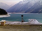
Buiratau National Park Location: Area: 890 km² On the map: 2 Links: Description: IUCN category II (National Park). |
 |
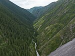
Location: Area: 199,621 ha On the map: 3 Links: Description: IUCN category II (National Park). Tentative World Heritage Site. |
 |
Natural Monument "Chinturgen firry grove" Location: Almaty Region, Enbekshikazakh District Area: 900 ha On the map: 1 Links: Description: IUCN category III (Natural Monument or Feature). |
 |
Location: Area: 182,076 ha On the map: 4 Links: Description: IUCN category II (National Park). |
 |
Natural Monument "Fire Hill" Location: Akmola Region, Zerendi District On the map: 2 Links: Description: IUCN category III (Natural Monument or Feature). |
 |
Natural Monument "Hill «Review»" Location: North Kazakhstan Region, Aiyrtau District On the map: 3 Links: Description: IUCN category III (Natural Monument or Feature). |
 |
Natural Monument "Hill «Two brothers»" Location: North Kazakhstan Region, Aiyrtau District On the map: 4 Links: Description: IUCN category III (Natural Monument or Feature). |
 |
Natural Monument "Island of lake "Imantau" Location: North Kazakhstan Region, Aiyrtau District On the map: 5 Links: Description: IUCN category III (Natural Monument or Feature). |
 |
Natural Monument "Raspberry cape" Location: Akmola Region, Zerendi District On the map: 6 Links: Description: IUCN category III (Natural Monument or Feature). |
 |
Natural Monument "Relic Array" Location: North Kazakhstan Region, Aiyrtau District On the map: 7 Links: Description: IUCN category III (Natural Monument or Feature). |
 |
Natural Monument "Rock sediments "Pot"" Location: North Kazakhstan Region, Aiyrtau District On the map: 8 Links: Description: IUCN category III (Natural Monument or Feature). |
 |
Natural Monument "Sharp hill" Location: North Kazakhstan Region, Aiyrtau District On the map: 9 Links: Description: IUCN category III (Natural Monument or Feature). |
 |
Natural Monument "Split hill" Location: North Kazakhstan Region, Aiyrtau District On the map: 10 Links: Description: IUCN category III (Natural Monument or Feature). |
 |
Natural Monument "Waterfall with cave" Location: North Kazakhstan Region, Aiyrtau District On the map: 11 Links: Description: IUCN category III (Natural Monument or Feature). |
 |
State Natural Monument "Green cape" Location: Akmola Region, Zerendi District On the map: 12 Links: Description: IUCN category III (Natural Monument or Feature). |
 |
State Natural Monument "Hill «Strekach»" Location: Akmola Region, Zerendi District On the map: 13 Links: Description: IUCN category III (Natural Monument or Feature). |
 |
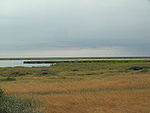
State Natural Monument "Piceous hill" Location: Akmola Region, Zerendi District Area: 0.01 km² On the map: 14 Links: Description: IUCN category III (Natural Monument or Feature). |
 |
Location: Area: 258,963 ha On the map: 2 Links: Description: IUCN category Ia (Strict Nature Reserve). Ramsar site. Part of UNESCO World Heritage Site «Saryarka – Steppe and Lakes of Northern Kazakhstan». |
 |
State Reserved Zone in Northern part of Caspian Sea Location: On the map: 1 Links: Description: |
 |
Zhusandala State Reserved Zone Location: On the map: 2 Links: Description: IUCN category VI (Protected Area with sustainable use of natural resources). |
Abai Region
править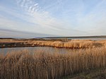 |
Kuludzhun State Nature Sanctuary (zoological) Location: Abai Region, Kokpekti District On the map: 2 Links: Description: IUCN category IV (Habitat/Species Management Area). |
 |
State Forest Nature Reservat "Semey Ormany" Location: Abai Region Area: 662,167 ha On the map: 3 Links: Description: IUCN category VI (Protected Area with sustainable use of natural resources). |
 |
Tarbagatai National Park Location: Abai Region, Urzhar District Area: 143,550.5 ha On the map: 5 Links: Description: IUCN category II (National Park). |
Akmola Region
править |
Atbasar State Nature Sanctuary (zoological) Location: Akmola Region, Atbasar District Area: 751 km² On the map: 3 Links: Description: IUCN category IV (Habitat/Species Management Area). |
 |
Location: Akmola Region, Birzhan sal District On the map: 4 Links: Description: IUCN category IV (Habitat/Species Management Area). |
 |
Jackdaw hill Location: Akmola Region, Birzhan sal District On the map: 15 Links: Description: IUCN category III (Natural Monument or Feature). |
 |
State Natural Monument "Relic pond" Location: Akmola Region, Birzhan sal District On the map: 16 Links: Description: IUCN category III (Natural Monument or Feature). |
 |
State Natural Monument "Sharp hill «Helmet»" Location: Akmola Region, Birzhan sal District On the map: 17 Links: Description: IUCN category III (Natural Monument or Feature). |
 |
Location: Akmola Region, Burabay District Area: 129,299 ha On the map: 6 Links: Description: IUCN category II (National Park). |
 |
East State Nature Sanctuary (zoological) Location: Akmola Region, Birzhan sal District On the map: 5 Links: Description: IUCN category IV (Habitat/Species Management Area). |
Aktobe Region
править |
Ebita Location: Aktobe Region, Kargaly District Area: 83,770 ha On the map: 6 Links: Description: zakaznik. |
 |
Irgiz-Torgay State Nature Reservat Location: Aktobe Region, Yrgyz District Area: 1,173,511 ha On the map: 4 Links: Description: IUCN category VI (Protected Area with sustainable use of natural resources). |
 |
Kobda sanctuary Location: Aktobe Region, Kobda District Area: 34,655 ha On the map: 7 Links: Description: zakaznik. |
 |
Kokjide-Qumjargan sanctuary Location: Aktobe Region, Mugalzhar District Area: 43,977 ha On the map: 8 Links: Description: zakaznik. |
 |
Martuk sanctuary Location: Aktobe Region, Martuk District Area: 133,796 ha On the map: 9 Links: Description: zakaznik. |
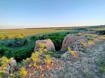 |
Oiyl sanctuary Location: Aktobe Region, Oiyl District Area: 63,467.54 ha On the map: 10 Links: Description: zakaznik. |
 |
Orqash sanctuary Location: Aktobe Region, Mugalzhar District Area: 33,395 ha On the map: 11 Links: Description: zakaznik. |
 |
Ozerny sanctuary Location: Aktobe Region, Ayteke Bi District Area: 154,083 ha Links: Description: zakaznik. |
 |
Turgay State Nature Sanctuary (zoological) Location: Aktobe Region, Yrgyz District On the map: 12 Links: Description: IUCN category IV (Habitat/Species Management Area). |
Almaty
править |
Almaty Botanical Garden Location: Almaty, Bostandyk district Area: 103.6 ha On the map: 1 Links: Description: botanical garden. |
 |
Baum's grove Location: Almaty, Turksib District Area: 137.7086 ha On the map: 18 Links: Description: IUCN category IV (Habitat/Species Management Area). |
 |
Kok Tobe Location: Almaty, Medeu district On the map: 13 Links: Description: zakaznik. |
Almaty Region
править |
Almaty State Nature Reserve Location: Almaty Region Area: 71,700 ha On the map: 1 Links: Description: IUCN category Ia (Strict Nature Reserve). |
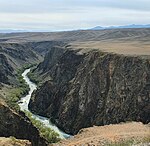 |
Location: Almaty Region Area: 127,050 ha On the map: 7 Links: Description: IUCN category II (National Park). |
 |
Natural Monument "Charyn ash forest" Location: Almaty Region, Uygur District Area: 4,855 ha On the map: 19 Links: Description: IUCN category III (Natural Monument or Feature). |
 |
Esik arboretum Location: Almaty Region, Enbekshikazakh District, Baltabay rural district, Aqtogai Area: 365.43 ha On the map: 1 Links: Description: arboretum. |
 |
Ile-Balkhash State Nature Reserve Location: Almaty Region Area: 415,164.2 ha On the map: 5 Links: Description: IUCN category VI (Protected Area with sustainable use of natural resources). |
 |
Ily Botanical Garden Location: Almaty Region, Balkhash District Area: 91 ha On the map: 2 Links: Description: botanical garden. |
 |
Karoi State Nature Sanctuary (complex) Location: Almaty Region, Balkhash District Area: 295,396.1 ha On the map: 14 Links: Description: IUCN category IV (Habitat/Species Management Area). |
 |
Kolsay Lakes National Park Location: Almaty Region Area: 161,045 ha On the map: 8 Links: Description: IUCN category II (National Park). |
 |
Pribalkhash State Nature Sanctuary (complex) Location: Almaty Region, Balkhash District Area: 503,000 ha On the map: 15 Links: Description: IUCN category IV (Habitat/Species Management Area). |
Astana
править |
Astana botanical garden Location: Astana, Esil District Area: 89.2 ha On the map: 3 Links: Description: botanical garden. |
Atyrau Region
править |
Novinskiy State Nature Sanctuary (zoological) Location: Atyrau Region, Kurmangazy District On the map: 16 Links: Description: IUCN category IV (Habitat/Species Management Area). |
 |
State Nature Reservat "Akzhaiyk" Location: Atyrau Region, Makhambet District Area: 111,500 ha On the map: 6 Links: Description: IUCN category VI (Protected Area with sustainable use of natural resources). |
East Kazakhstan Region
править |
Altay Botanical Garden Location: East Kazakhstan Region, , Ridder Area: 154.2 ha On the map: 4 Links: Description: botanical garden. |
 |
Ayudy sanctuary Location: East Kazakhstan Region, Ulan District Area: 5,873.8022 ha On the map: 17 Links: Description: zakaznik. |
 |
Katon-Karagay National Park Location: East Kazakhstan Region, Katonkaragay District Area: 6,434.77 km² On the map: 9 Links: Description: IUCN category II (National Park). |
 |
Markakol State Nature Reserve Location: East Kazakhstan Region, Kurshim District Area: 102,971 ha On the map: 7 Links: Description: IUCN category Ia (Strict Nature Reserve). |
 |
Natural Monument "Sinegorskaya firry grove" Location: East Kazakhstan Region, Ulan District On the map: 20 Links: Description: IUCN category III (Natural Monument or Feature). |
 |
Nizhne-Turgusun State Nature Sanctuary (botanical) Location: East Kazakhstan Region, Altai District On the map: 18 Links: Description: IUCN category IV (Habitat/Species Management Area). |
 |
State Nature Sanctuary "Karatal Sands" (botanical) Location: East Kazakhstan Region, Altai District On the map: 19 Links: Description: IUCN category IV (Habitat/Species Management Area). |
 |
State Nature Sanctuary "South Altay" Location: East Kazakhstan Region, Kurshim District On the map: 20 Links: Description: IUCN category IV (Habitat/Species Management Area). |
 |
Tarbagatay State Nature Sanctuary (zoological) Location: East Kazakhstan Region On the map: 21 Links: Description: IUCN category IV (Habitat/Species Management Area). |
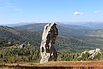 |
West-Altay State Nature Reserve Location: East Kazakhstan Region, Altai District Area: 86,122 ha On the map: 8 Links: Description: IUCN category Ia (Strict Nature Reserve). |
Jambyl Region
править |
Andasay State Nature Sanctuary (zoological) Location: Jambyl Region, Moiynkum District On the map: 22 Links: Description: IUCN category IV (Habitat/Species Management Area). |
 |
Betpakdala sancuary Location: Jambyl Region, Sarysu District Area: 1,415,861 ha On the map: 23 Links: Description: zakaznik. |
 |
Korday-Zhaysan sanctuary Location: Jambyl Region Area: 369,970.16 ha On the map: 24 Links: Description: zakaznik. |
 |
Merke sanctuary Location: Jambyl Region, Merki District Area: 68,910 ha On the map: 25 Links: Description: zakaznik. |
 |
State Nature Sanctuary "Berkara Tract" (complex) Location: Jambyl Region, Zhualy District On the map: 26 Links: Description: IUCN category IV (Habitat/Species Management Area). |
 |
State Nature Sanctuary "Karakonuz Tract" (botanical) Location: Jambyl Region, Korday District Area: 3,070 ha On the map: 27 Links: Description: IUCN category IV (Habitat/Species Management Area). |
 |
Umbet sanctuary Location: Jambyl Region Area: 298,400 ha On the map: 28 Links: Description: zakaznik. |
 |
Zhualy-Karashat sanctuary Location: Jambyl Region Area: 148,300 ha Links: Description: zakaznik. |
Karaganda Region
править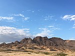 |
Bektauata State Zoological Nature Sanctuary Location: Karaganda Region, Aktogay District On the map: 29 Links: Description: IUCN category IV (Habitat/Species Management Area). |
 |
Belagash State Nature Sanctuary (zoological) Location: Karaganda Region, Bukhar-Zhyrau District On the map: 30 Links: Description: IUCN category IV (Habitat/Species Management Area). |
 |
Bugyly Sanctuary Location: Karaganda Region, Shet District Area: 85 km² On the map: 31 Links: Description: zakaznik. |
 |
Location: Karaganda Region, Karkaraly District Area: 112.12 km² On the map: 10 Links: Description: IUCN category II (National Park). |
 |
State Nature Sanctuary "Beldeutas" (zoological) Location: Karaganda Region, Karkaraly District On the map: 32 Links: Description: IUCN category IV (Habitat/Species Management Area). |
 |
Kuvskiy State Nature Sanctuary (zoological) Location: Karaganda Region, Karkaraly District On the map: 33 Links: Description: IUCN category IV (Habitat/Species Management Area). |
 |
Kyzylaray State Nature Sanctuary (zoological) Location: Karaganda Region, Aktogay District On the map: 34 Links: Description: IUCN category IV (Habitat/Species Management Area). |
 |
Turanga State Nature Sanctuary (botanical) Location: Karaganda Region, Aktogay District Area: 0.05 km² On the map: 35 Links: Description: IUCN category IV (Habitat/Species Management Area). |
Kostanay Region
править |
Mikhailov State Nature Sanctuary (zoological) Location: Kostanay Region, Karabalyk District On the map: 36 Links: Description: IUCN category IV (Habitat/Species Management Area). |
 |
Location: Kostanay Region Area: 191,381 ha On the map: 9 Links: Description: IUCN category Ia (Strict Nature Reserve). Part of UNESCO World Heritage Site «Saryarka – Steppe and Lakes of Northern Kazakhstan». |
 |
State Nature Reservat "Altyn Dala" Location: Kostanay Region Area: 489,766 ha On the map: 10 Links: Description: IUCN category VI (Protected Area with sustainable use of natural resources). |
 |
State Nature Sanctuary Zharsor-Urkash (zoological) Location: Kostanay Region, Kamysty District On the map: 37 Links: Description: IUCN category IV (Habitat/Species Management Area). |
 |
Tounsor State Nature Sanctuary (zoological) Location: Kostanay Region, Kamysty District On the map: 38 Links: Description: IUCN category IV (Habitat/Species Management Area). |
Kyzylorda Region
править |
Barsa-Kelmes Nature Reserve Location: Kyzylorda Region, Aral District Area: 163,126 ha On the map: 11 Links: Description: IUCN category Ia (Strict Nature Reserve). |
 |
State Nature Sanctuary Kargaly (zoological) Location: Kyzylorda Region Area: 0.132 km² On the map: 39 Links: Description: IUCN category IV (Habitat/Species Management Area). |
 |
Torangylsay State Nature Sanctuary (zoological) Location: Kyzylorda Region, Syrdariya District On the map: 40 Links: Description: IUCN category IV (Habitat/Species Management Area). |
Mangystau Region
править |
Adamtas sanctuary Location: Mangystau Region, Karakiya District Area: 68,374.3 ha Links: Description: zakaznik. |
 |
Aktau-Buzachi State Zoological Nature Sanctuary Location: Mangystau Region, Tupkaragan District Area: 170,000 ha On the map: 41 Links: Description: IUCN category IV (Habitat/Species Management Area). |
 |
Eset sanctuary Location: Mangystau Region, Beyneu District Area: 146,790 ha Links: Description: zakaznik. |
 |
Kenderly-Kayasan State Reserved Zone Location: Mangystau Region, Karakiya District On the map: 3 Links: Description: |
 |
Kolenkeli sanctuary Location: Mangystau Region, Beyneu District Area: 58,922.8 ha Links: Description: zakaznik. |
 |
Kyzylsay regional nature park Location: Mangystau Region, Mangystau District Area: 68,445 ha On the map: 11 Links: Description: nature park. |
 |
Manashy sanctuary Location: Mangystau Region Area: 228,028.2 ha Links: Description: zakaznik. |
 |
Mangyshlak experimental Botanical Garden Location: Mangystau Region, , Aktau Area: 39 ha On the map: 5 Links: Description: botanical garden. |
 |
State Nature Sanctuary Karakiya-Karakol (zoological) Location: Mangystau Region, Karakiya District On the map: 42 Links: Description: IUCN category IV (Habitat/Species Management Area). |
 |
Tasorpa sanctuary Location: Mangystau Region, Mangystau District Area: 160,086.48 ha Links: Description: zakaznik. |
 |
Ustyurt Nature Reserve Location: Mangystau Region, Karakiya District Area: 223,342 ha On the map: 12 Links: Description: IUCN category Ia (Strict Nature Reserve). |
 |
Zhabayushkan sanctuary Location: Mangystau Region Area: 316,141 ha On the map: 43 Links: Description: zakaznik. |
North Kazakhstan Region
править |
Mamlut State Nature Sanctuary (zoological) Location: North Kazakhstan Region, Mamlyut District On the map: 44 Links: Description: IUCN category IV (Habitat/Species Management Area). |
 |
Natural Monument "Pinery" Location: North Kazakhstan Region, Kyzylzhar District, Sokolovsky rural settlement Area: 26 ha On the map: 21 Links: Description: IUCN category III (Natural Monument or Feature). |
 |
Natural Monument "Zhanazhol" Location: North Kazakhstan Region, Zhambyl District, North Kazakhstan Region Area: 9 ha On the map: 22 Links: Description: IUCN category III (Natural Monument or Feature). |
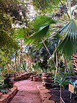 |
Northern Botanical Garden Location: North Kazakhstan Region, , Petropavl On the map: 6 Links: Description: botanical garden. |
 |
Location: North Kazakhstan Region, Aiyrtau District On the map: 45 Links: Description: IUCN category IV (Habitat/Species Management Area). |
 |
Natural Monument "Eagle mountain" hill and spring key " Location: North Kazakhstan Region, Aiyrtau District On the map: 23 Links: Description: IUCN category III (Natural Monument or Feature). |
 |
Silver pine forest Location: North Kazakhstan Region, Kyzylzhar District On the map: 24 Links: Description: natural monument. |
 |
Smirnov State Nature Sanctuary (zoological) Location: North Kazakhstan Region, Akkayin District On the map: 46 Links: Description: IUCN category IV (Habitat/Species Management Area). |
 |
Sogrov State Nature Sanctuary (zoological) Location: North Kazakhstan Region On the map: 47 Links: Description: IUCN category IV (Habitat/Species Management Area). |
Pavlodar Region
править |
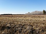
Bayanaul National Park Location: Pavlodar Region, Bayanaul District Area: 68,453 ha On the map: 12 Links: Description: IUCN category II (National Park). |
 |
State Forest Nature Reservat "Ertis Ormany" Location: Pavlodar Region Area: 277,961 ha On the map: 13 Links: Description: IUCN category VI (Protected Area with sustainable use of natural resources). |
 |
Location: Pavlodar Region On the map: 48 Links: Description: IUCN category IV (Habitat/Species Management Area). |
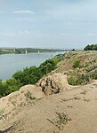 |
Goose flight Location: Pavlodar Region, Pavlodar District On the map: 25 Links: Description: IUCN category III (Natural Monument or Feature). |
 |
State Nature Sanctuary Kyzyltau (zoological) Location: Pavlodar Region, Bayanaul District On the map: 49 Links: Description: IUCN category IV (Habitat/Species Management Area). |
Shymkent
правитьTurkistan Region
править |
Akdala State Nature Sanctuary (botanical) Location: Turkistan Region, Arys Qalasy, Arys On the map: 50 Links: Description: IUCN category IV (Habitat/Species Management Area). |
 |
Aksu-Zhabagly Nature Reserve Location: Turkistan Region Area: 128,118.1 ha On the map: 14 Links: Description: IUCN category Ia (Strict Nature Reserve). Tentative World Heritage Site. |
 |
Arys and Karatau State Reserved Zone Location: Turkistan Region On the map: 4 Links: Description: IUCN category VI (Protected Area with sustainable use of natural resources). |
 |
Boralday State Nature Sanctuary (botanical) Location: Turkistan Region, Tulkibas District On the map: 51 Links: Description: IUCN category IV (Habitat/Species Management Area). |
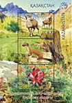 |
Location: Turkistan Region Area: 34,300 ha On the map: 15 Links: Description: IUCN category Ia (Strict Nature Reserve). Part of UNESCO World Heritage Site «Western Tian Shan». |
 |
Koshkorgan paleontological natural monument Location: Turkistan Region, Sauran district Area: 0.03 ha Links: Description: natural monument. |
 |
Kyzylkol Location: Turkistan Region, Sozak District Area: 800 ha On the map: 27 Links: Description: natural monument. |
 |
Lake Zhesibay of Keltemashat Location: Turkistan Region Area: 0.5 ha Links: Description: natural monument. |
 |
Red hill Location: Turkistan Region, Tulkibas District Area: 20 ha On the map: 28 Links: Description: natural monument. |
 |
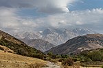
Sastogai Location: Turkistan Region Area: 30 ha Links: Description: natural monument. |
 |
Sayram-Ugam National Park Location: Turkistan Region Area: 149,037.1 ha On the map: 13 Links: Description: IUCN category II (National Park). |
 |
Sea Buckthorn grove Location: Turkistan Region Area: 30 ha Links: Description: natural monument. |
 |
South Kazakhstan State Reserved Zone' Location: Turkistan Region On the map: 5 Links: Description: IUCN category VI (Protected Area with sustainable use of natural resources). |
 |
Stalactite cave Location: Turkistan Region, Tulkibas District Area: 0.5 ha On the map: 29 Links: Description: natural monument. |
 |
State Nature Sanctuary Zadarya (botanical) Location: Turkistan Region, Arys Qalasy, Arys On the map: 52 Links: Description: IUCN category IV (Habitat/Species Management Area). |
 |
State Nature Sanctuary Zhambyl (botanical) Location: Turkistan Region, Baydibek District On the map: 53 Links: Description: IUCN category IV (Habitat/Species Management Area). |
 |
Location: Turkistan Region Area: 119,978.4 ha On the map: 14 Links: Description: IUCN category II (National Park). |
 |
Boralday Location: Turkistan Region, Baydibek District Area: 1,000 ha On the map: 30 Links: Description: natural monument. |
 |
Koshkarata canyon Location: Turkistan Region, Baydibek District Area: 634 ha On the map: 31 Links: Description: natural monument. |
 |
Shukyrshak Location: Turkistan Region, Baydibek District Area: 10 ha On the map: 32 Links: Description: natural monument. |
 |
Tesik tam Location: Turkistan Region Area: 200 ha Links: Description: natural monument. |
 |
Timurskiy State Nature Sanctuary (botanical) Location: Turkistan Region, Otyrar District On the map: 54 Links: Description: IUCN category IV (Habitat/Species Management Area). |
Ulytau Region
править |
Kogashik State Nature Sanctuary (botanical) Location: Ulytau Region, Zhanaarka District Area: 150 km² On the map: 55 Links: Description: IUCN category IV (Habitat/Species Management Area). |
 |
State Nature Sanctuary Karaagash (zoological) Location: Ulytau Region, Zhanaarka District Area: 6,800 ha On the map: 56 Links: Description: IUCN category IV (Habitat/Species Management Area). |
 |
Location: Ulytau Region, Ulytau District Area: 58,900 ha On the map: 15 Links: Description: IUCN category II (National Park). |
 |
Ulytau State Nature Sanctuary Location: Ulytau Region, Ulytau District Area: 19,300 ha On the map: 57 Links: Description: IUCN category IV (Habitat/Species Management Area). |
 |
Zheskazgan Botanical Garden Location: Ulytau Region, Zhezqazghan Qalasy, Jezkazgan Area: 62 ha On the map: 7 Links: Description: botanical garden. |
West Kazakhstan Region
править |
Ak-Kum sanctuary Location: West Kazakhstan Region, Shyngyrlau District Area: 7,984 ha On the map: 58 Links: Description: zakaznik. |
 |
Ashchiozek sanctuary Location: West Kazakhstan Region Area: 314,504.1 ha Links: Description: zakaznik. |
 |
Bokeyorda Location: West Kazakhstan Region On the map: 16 Links: Description: |
 |
Bolshaya Ichka mountain Location: West Kazakhstan Region, Taskala District Area: 175 ha On the map: 33 Links: Description: natural monument. |
 |
Budari State Nature Sanctuary (zoological) Location: West Kazakhstan Region Area: 80,000 km² On the map: 59 Links: Description: IUCN category IV (Habitat/Species Management Area). |
 |
Dubrava sanctuary Location: West Kazakhstan Region, Terekti District Area: 6 ha On the map: 60 Links: Description: zakaznik. |
 |
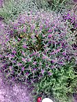
Kirsanov State Nature Sanctuary (complex) Location: West Kazakhstan Region Area: 61,000 ha On the map: 61 Links: Description: IUCN category IV (Habitat/Species Management Area). |
 |
Mirgorodskiy sanctuary Location: West Kazakhstan Region, Borili District Area: 3,950 ha Links: Description: zakaznik. |
 |
Sadovskoye Lake Location: West Kazakhstan Region, Bayterek District Area: 150 ha On the map: 34 Links: Description: natural monument. |
 |
Selektsionny sanctuary Location: West Kazakhstan Region, Bayterek District Area: 36.3 ha Links: Description: zakaznik. |
 |
State Nature Sanctuary Zhaltyrkul (zoological) Location: West Kazakhstan Region, Jañaqala district Area: 190 km² On the map: 62 Links: Description: IUCN category IV (Habitat/Species Management Area). |
 |
Urda sanctuary Location: West Kazakhstan Region, Bokey Orda District Area: 16,405 ha Links: Description: zakaznik. |
Zhetisu Region
править |
Location: Zhetisu Region Area: 4,596 km² On the map: 16 Links: Description: IUCN category II (National Park). Tentative World Heritage Site. |
 |
Natural Monument «Singing barchans» Location: Zhetisu Region, Kerbulak District On the map: 35 Links: Description: IUCN category III (Natural Monument or Feature). |
 |
Kukan State Nature Sanctuary (zoological) Location: Zhetisu Region, Sarkand District Area: 49,100 ha On the map: 63 Links: Description: IUCN category IV (Habitat/Species Management Area). |
 |
Tokty State Nature Sanctuary (zoological) Location: Zhetisu Region, Alakol District On the map: 64 Links: Description: IUCN category IV (Habitat/Species Management Area). |
 |
Verkhnekoksu State Zoological Nature Sanctuary Location: Zhetisu Region, Kerbulak District Area: 240,000 ha On the map: 65 Links: Description: IUCN category IV (Habitat/Species Management Area). |
 |
Location: Zhetisu Region Area: 356,022 ha On the map: 17 Links: Description: IUCN category II (National Park). |
 |
Lepsi State Zoological Nature Sanctuary Location: Zhetisu Region Area: 2,580 km² On the map: 66 Links: Description: IUCN category IV (Habitat/Species Management Area). |


